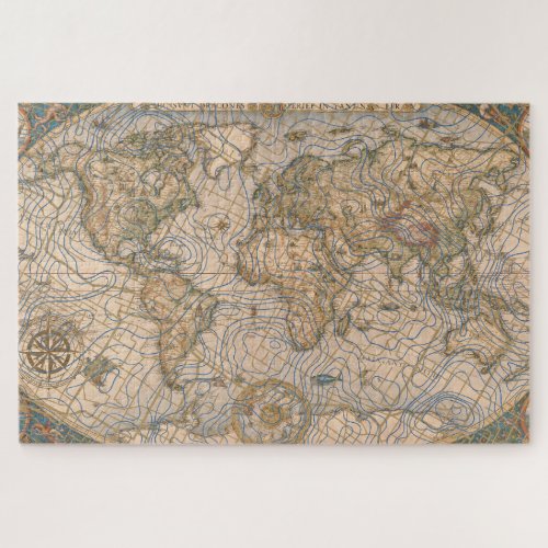
Mappa Mundi Jigsaw Puzzle
by MontSylvain
„Mappa Mundi“ (Latin: "map of the world") refers to the distinctive medieval European cartographic tradition that flourished from the eighth to the fifteenth centuries—artefacts that have long commanded the attention of antiquarians, collectors, and historians of cartography.
From an antiquarian perspective, these objects are prized not merely as geographical documents but as material witnesses to the medieval intellectual imagination. Unlike modern maps oriented toward precise navigation, the „mappa mundi“ served theological and encyclopedic purposes, typically depicting the world as a circular disk (following the T-O schema) with Jerusalem at the center, the Orient at the top, and the Garden of Eden often perched at the eastern edge. The surviving parchment examples—such as the monumental Hereford Mappa Mundi (c. 1300), the destroyed Ebstorf map (reconstructed from nineteenth-century copies), and the smaller Psalter maps—represent rare survivals of medieval manuscript culture, their vellum surfaces crowded with biblical narratives, classical mythology, and monstrous races drawn from Plinian and Solinian traditions.
For the antiquarian, these maps present particular challenges of provenance and interpretation. Many exist as unique copies or fragments, their pigments faded, their Latin inscriptions corrupted, their edges trimmed by later binders. The study of „mappae mundi“ requires paleographical expertise to date hands and identify scriptoria, codicological analysis to reconstruct original dimensions and formats, and iconographic scholarship to decode the complex interplay of sacred geography and secular knowledge. Collectors have historically prized them as the cartographic equivalent of illuminated manuscripts — luxury objects where geography, history, and theology converge on a single sheet.
Created with Canva, Venice.ai & love.
$77.05
Related Products